
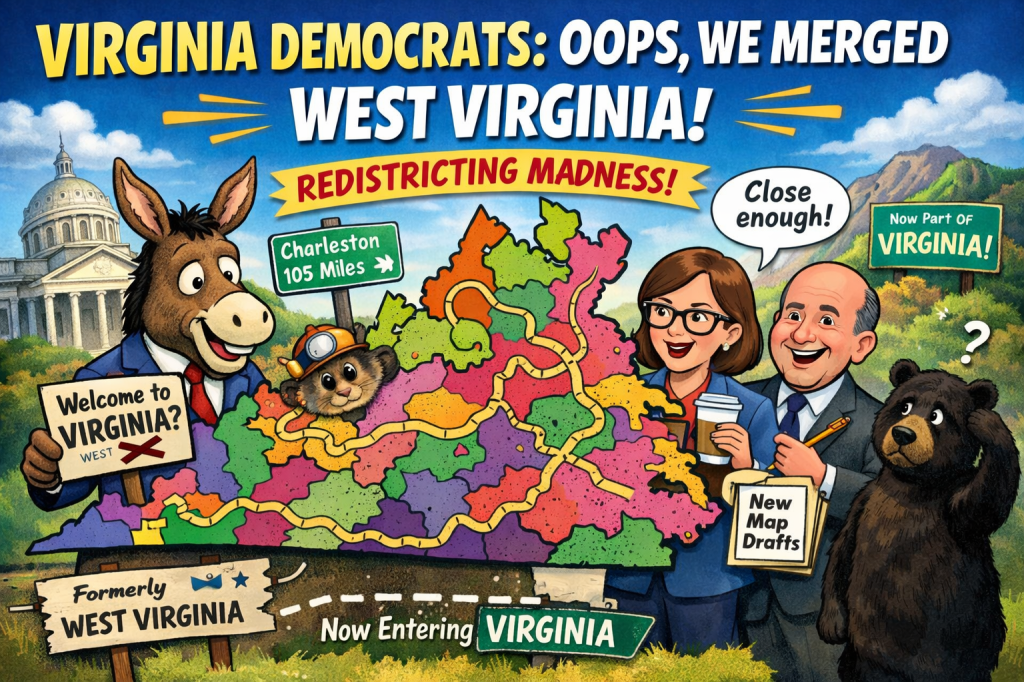
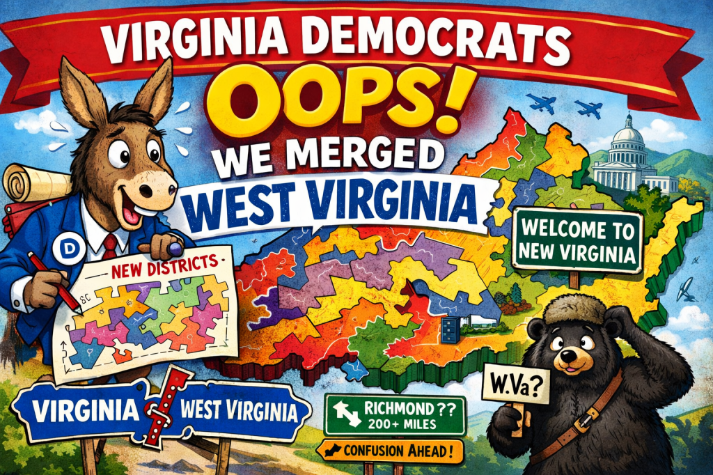
RICHMOND — In what aides are calling “a bold, inclusive, geographically experimental moment,” Virginia Democrats on Tuesday unveiled a newly redrawn congressional map that—after several hours, three coffee refills, and one frantic call from Charleston—appears to have accidentally merged West Virginia into Virginia.
The error was discovered when a staffer noticed that a proposed 11th Congressional District stretched from Arlington to Morgantown, followed the Appalachian Trail for no discernible reason, and included a note in the margin reading: “Coal voters? Ask later.”
“We didn’t merge West Virginia,” a senior Democratic strategist clarified while gesturing vaguely at a map that now resembled a spilled plate of spaghetti. “We simply created a district that honors regional connectivity. And by connectivity, we mean vibes.”
A Map That Defies Physics, History, and Basic Direction
The new map, which Democrats insist is “fair, compact, and community-driven,” includes districts shaped like question marks, one shaped like a salamander wearing glasses, and another that appears to be legally contiguous only if one accepts wormholes as valid transportation infrastructure.
District 7, for example, begins in Fairfax County, jogs west through Shenandoah, briefly dips into what used to be the sovereign state of West Virginia, then returns to Virginia “emotionally,” according to the accompanying legal memo.
Asked whether this violated state boundaries, a map consultant replied, “Boundaries are a social construct.”
West Virginia Officials Learn the News From Twitter
West Virginia officials reportedly learned of their annexation the same way everyone else did: a screenshot posted online with the caption “Why is my vote now in Virginia?”
“We were not consulted,” said one confused West Virginia lawmaker. “But I did get an email asking me to attend a Virginia Democratic caucus call, so… I guess that’s my life now.”
Residents of Charleston expressed mixed emotions. Some welcomed the possibility of better roads. Others worried they would now be required to explain Richmond politics at Thanksgiving.
Gerrymandering, But Make It Abstract Art
Democrats defended the map as a necessary response to decades of partisan gerrymandering, noting that the new lines were drawn using a “values-forward algorithm” that prioritized equity, competitiveness, and the personal horoscope of the intern operating Adobe Illustrator.
Critics, however, argue the map is less “representational democracy” and more “Etch A Sketch dropped down a stairwell.”
“It’s not gerrymandering if the shape is unknowable,” one party spokesperson said. “You can’t rig what no one understands.”
A Simple Fix Is Promised
Party leaders say the issue will be corrected before the next election—likely by “un-merging” West Virginia, straightening a few lines, and ensuring future maps do not cross state borders, rivers, or metaphysical planes of existence.
Until then, Virginians are advised to double-check which state they live in before voting, filing taxes, or pledging allegiance.
West Virginians, meanwhile, are encouraged to remain calm and continue living their lives as usual—unless summoned to Richmond for a committee hearing, in which case, carpooling is encouraged.
Keep Political Party Animals Free
Political Party Animals exists to laugh at politics so we don’t cry about it. Satire, parody, and absurdity are how we call out hypocrisy, nonsense, and the occasional clown show in public life.
If this piece made you laugh, groan, or say “yep, that tracks,” reader support helps keep the satire sharp and independent.
